Showing posts with label New Zealand. Show all posts

Wednesday, May 17, 2017

Hurry Up and Wait

gribLow
We spent yesterday (NZ Wednesday) doing our final preps for leaving today for Fiji. Made our appointment for 9:00am with Customs and Immigration to clear out. A front moved through last night over NZ giving us some strong, but nice direction, winds for leaving this afternoon. Just one fly in the ointment, the GRIB models have now decided to agree with each other and significantly strengthen a low forming in the tropics just about the time we would be getting to Fiji. Fiji is the gray islands at the top middle-left of the image above. You can see the wind arrows with many feathers on them, ie, lots of winds, as well as the dark precipitation bands. The models have the low moving off to the SE, so we’ve decided to delay at least one more day. If the wave height was not predicted to be so large at 5.4m (17ft) we would go as far as Minvera Reef and sit inside there for a few days. But the reef is so low that those waves will just march through there making for a very uncomfortable stay.
Hard to believe we’ve trying to get out of NZ since the beginning of May. Our friend Bill from San Francisco has been hanging on trying to make the passage with us as crew-- we’re not sure how much longer he’ll be able to hang out.
franklintrump
All this waiting does give me time to catch up on the Circus that is our White House these days. The key question is how many self-inflicted wounds can one presidency take? Even a POTUS as huge as the Trump only has 10 toes and it is so hard to walk after shooting all ten of them off. It really is a bit disconcerting when you first meet people down here and very early in the conversation you hear them delicately (and some not so delicately) trying to figure out what side of the Trump divide we’re on before they continue the conversation.
Paul

Saturday, May 13, 2017

Passage Planning Tools: Fastseas

Fastseas1
We are still sitting in the Bay of Islands, New Zealand waiting for good weather to head to Fiji. Thought I’d write a little about some of the passage planning tools I use – OK, this blog is not a travelogue, more for other cruisers.
One tool I really like while we still have decent Internet is www.fastseas.com. This is a weather routing program that uses the interface of www.windy.com and the GFS weather model along with the specifics of your boat (polars) to create an optimum route for a passage. Once you’ve selected a Start and Finish location you enter the start date and time and have it calculate a route. In the image above the calculated route is the brown line. Fastseas will route for optimum speed, around land and to avoid high winds.
fastseas2
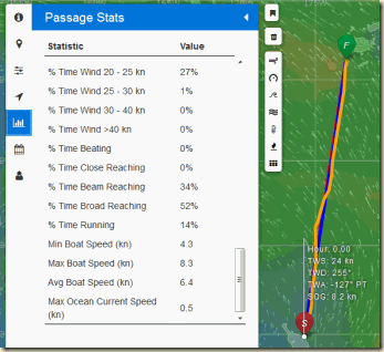
You can then look at the Stats about the calculated route: how many days, how many hours motoring, percentage of time beating/reaching/running, maximum wind speeds, minimum wind speeds, average boat speed, etc.
fastseas4
You can setup the polars for your boat describing how she points and what speed she does for various wind speeds and directions (or use the generic polar). This tab also lets you enter at what boat speed you will decide to motor and how fast you will motor.

fastseas3
One of the best features is the Departure Planning tab. It creates a route for the next ten days or so, assuming your original start date and time. You can then compare the Stats for each day and make a better decision on what day is the optimum departure date. For us we are trying to number one minimize the beating (sailing close to the wind, which is uncomfortable offshore) and number two to minimize motoring (hate that racket and dinosaur consumption).
currents
There are few things that I’d like to see improved on Fastseas, but Jeremy, the developer of Fastseas is pretty active doing updates and making sure the program scales to the number of users. He’s had to add a small fee for unlimited use (free to use multiple times per month and try out) to help cover the Amazon Web Services Cloud computing costs.
One item I don’t like is that Fastseas uses the current predictions in its optimization. While this sounds good in theory and probably works well say in the Atlantic where the Gulf Stream moves in a fairly consistent river of water. The image above is a display of the current predictions between New Zealand and Fiji. You probably can’t make it from the image but basically the currents are just all over the place. Being 20 miles west of your position might reverse the .5 kt current shown on the display. In practice these predictions are useless on this passage and just add error to the optimization. Fortunately its not much error because the currents are small and somewhat random.
Give FastSeas.com a try next time you are planning passage.
Paul

Tuesday, May 9, 2017

The Girls–Donna and Ella

17-nasaseestrop
This NASA picture of Cyclone Donna, on the left, and newly minted Cyclone Ella, on the right, has kinda put the kibosh on heading to Fiji – which is inconveniently located directly between the swirls in this picture. Donna is the strongest cyclone ever recorded in May in this area. While a cyclone can very occasionally happen in any month in the South Pacific, having two past the end of the season simultaneously is pretty rare. We really thought that this weekend would give us a window to get moving on the passage. But with Ella just getting going plus an unexpected Low showing up in the weather models in the Tasman next Tuesday it is looking more like we will be waiting in New Zealand for a while longer.

While I greatly appreciate you informing me, on three separate occasions, that I am not under investigation, I nevertheless concur with the judgment of the Department of Justice that you are not able to effectively lead the Bureau.
D. Trump
Sitting here on the boat gives me plenty of time to browse the news. I just caught the latest where Trump fired the FBI Director Comey. From his letter firing Comey (snippet above) it sounds like he is firing Comey because he knows that any director who does not investigate him must be tainted and incompetent.
Paul

Friday, May 5, 2017

Passage Weather

pressurre
We’re sitting in the Bay of Islands, New Zealand waiting to catch a weather window to make the thousand mile passage to Fiji. Above is a barometric pressure display courtesy of windy.com. A great site for visualizing the weather anywhere in the world.  You can see our new acquaintance Donna in the upper center of the map. She started out as a small closed low located between New Caledonia and Vanuatu. Small lows in the tropics are something to watch closely when leaving NZ – more on that latter in this blog.
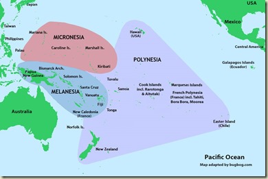
pacific-polynesia-map-1000
For those of you who don’t have a clue where New Caledonia and Vanuatu are, they are located near the bottom right of the area labeled Melanesia in the map above.
Now, that little low morphed into a deeper low over a few days and became Tropical Depression 21F. Not a very elegant name. Cyclone season is officially over at the end of April so at most 21F should have whipped up a little wind and waves and quickly dissipated. The whipped-up wind, however, managed to get strong enough to earn the title Cyclone Donna. Currently the winds are up to about 90-100kts and this earns her a Category 3 rating. The Cat ratings in the South Pacific are different than the Cat ratings used in the Atlantic hurricane season. Needless to say Cat 3 is significantly greater than breezy. Current predictions have her going South and then East. From there she will most likely become an extra-tropical low and connect with a frontal system that will lie between New Zealand and Fiji mid-next week.
My careful analysis of passage weather is that if there is a cyclone or something that begs to become a cyclone out there, then stay in port, no matter what the predicted track is. Most of the yachties planning to head to islands have also decided to wait out the situation. A few boats have left over last 2 or 3 days, mostly to Tonga. Not for me, I’ll ride on the chicken side. Cyclone rustling is not on my bucket list.
So back to the pressure map shown above. Donna is in the upper middle with some deep low pressure indicated by the purple. There are two large highs (orange/yellow) one over the Tasman Sea and New Zealand, the other over Australia. In between them in the Southern Ocean is a front with a low shown in blue.  Once Donna dissipates and heads a bit east the front that is in the Tasman should pass over NZ giving rain and northerly winds. As it passes by the winds will clock to SW and the high that is over Australia will move onto NZ. This should give us great boost all or most of the way to Fiji. Right now that looking like late Thursday or Friday (or maybe Saturday). Or maybe it will all change by then.
One of the nice features of windy.com is that you can click two different weather models. One is ECMWF, aka the Euro model, and GFS, aka the US model. When you look days into the future and the two models do not agree with each other, you can have high confidence that one or both is wrong. In other words the forecast isn’t good for much. If the two models converge onto predictions that are reasonably close then I have a lot more faith on them.
ramatha
Rescue of Ramtha by the HMSNZ Monowai. You can just see the bow of Ramtha in the left hand side and the crew being transferred toward the right in obviously horrendous conditions.
Back to why the small lows in the tropics are important to watch when leaving NZ.  In the first week of June, 1994 was the infamous Queen’s Birthday Storm. At least 8 boats were lost and three crew.
queensbirthday
Position of the Low and the yachts around it on June 4, 1994
A low moved across the path of the boats headed north. A large high was over the Tasman Sea and NZ.  This caused a compression zone between the high and the low. This is where the isobars (equal pressure lines) get pushed together causing a steep decline over a relatively short distance. The result of this was very high winds. The result of very high winds is very high seas. When this is bad enough it gets the name Weather Bomb.
We spend a lot of time digesting the weather sources before departure. This usually gets you a decent 2 to 3 days where you can be reasonably confident on what the conditions will be. After that you take what comes, making (hopefully minor) tactical course changes till your destination.
Paul

Monday, May 1, 2017

Duck Hunting Public Service Message

msc-no-meat-better-than-no-mate-logo-223
If you followed this blog last year then you might remember the start of last years duck hunting season in New Zealand where the first day score was Ducks 3, Hunters 0. New Zealand Duck Hunting Season Begins With High Scoring
We saw thgis sign on the side of the road the other day:
No Meat is Better than NO MATE
Identify your target beyond all doubt.
In other words don’t shoot at the first thing that rustles in bushes.

We left Riverside Drive Marina today on the noon high tide. Anchored out at Whangarei Heads tonight on a cool but sunny late afternoon. The plan is to head up to the Bay of Islands to await a weather window to make the passage to Fiji. At this point the window looks aways out. More on the weather next blog post.
Paul

Wednesday, April 26, 2017

It’s Fall (or is it Spring?)

BOIIMG_6606
Yea, I know it’s been a long time since any serious blogging has been accomplished on this side. So I thought I’d start out with a graceful picture of yours-truly enjoying an early fall SUP (Standup Paddleboard) in the Bay of Islands, NZ.
SUPIMG_1832
The thing I like about SUPing is lets me get a good audience for bad humor.
BOIIMG_6618
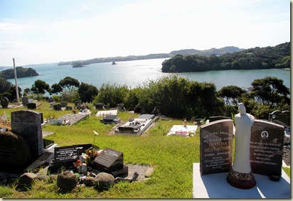
We enjoyed some great hikes while crusing NZ this season. A Maori grave yard over-looking the Bay of Islands…
BOIIMG_6619
…with Georgia parked all by herself under the cliffs.
March was the end of our New Zealand cruising for the season. We headed back south to Hatea River and Whangarei and got a slew of boat projects done at Riverside Drive Marina. Then it was off for a quick trip to the US of A. First stop was a long weekend at Chris’ Mom’s in Carlsbad (CA), with celebration of a big six-oh while there.
Then we headed up to Bellingham for a very important grandkid fix.
LaConnorIMG_6721
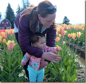
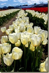
We hit the Skagit Valley at the peak of the Tulip season. Tulip production started here in the early 1900’s funded by the US Dept. of Agriculture with 15,000 bulbs imported from Holland – government subsidies at work. This pic is of the angel queen of the Tulip Festival – Queen Quinn of Ferndale.
LaConnorIMG_6719
Quinn is complaining to gramps here about having to look at flowers when there is great rusty stuff just behind them – an old tulip planter.
LaConnorIMG_6742
A color coordinated trio if I ever saw one!
LaConnorIMG_6769
Teaching the young to violate the no flower or petal picking policies.
ADL
Besides tiptoeing through the tulips while we were in Bellingham we caught up on some medical appointments. Updating your Advanced Medical Directives is a good thing occasionally. Some of the questions on the form were new to me, like the one above: In the event that you stop breathing or your heart stops beating and Donald Trump is President, would you want us to resuscitate you? This cartoon was sent to me from an anonymous medical officer off one of the Pacific cruising boats.
WhangareiIMG_6789
After a long flight from Vancouver to Auckland on Air New Zealand (really good airline), we are now getting ready to make our passage from New Zealand to Fiji. Here I am removing all the unneeded  packaging from my tea bags, while this might seem like reducing the footprint in the islands we go to, I like to think of it more as increasing our footprint while we are in a marina.
LaConnorIMG_6728
LaConnorIMG_6775
Now you might have figured I’d end this blog with some gratuitous pictures of our above average grandkid – but no, just some more flower pictures. 
Paul

Wednesday, February 8, 2017

Auckland, Big City Visit

AucklandIMG_6437
We decided to head into downtown Auckland for some city visit time. We anchored just across from the downtown, or as the Kiwis call it the CBD (Central Business District). We anchored outside the main channel at Bayswater, Waitamata Harbour (36*49.7S, 174* 45.7E). Took the dinghy into Basywater Marina and then jumped on the 10 minute ferry to the CBD.
First stop was to get some documents copied that we needed notarized. This entailed heading to the US Consulate in Auckland with the documents in hand. We took the elevator up and it opened into a security area. After a polite search, Xray and magnetometer scan we were buzzed in through the security doors into the inner waiting area. This area has about 8 bank teller like windows with bullet proof glass. It is long and narrow, with enough width to handle four chairs across and an aisle. After we dropped off our papers we took a seat in this waiting area. The funny part was that at each end of the room were large TV screens. On the one in front of us was what seemed like a US travel video playing without sound. There were numerous pictures of women in religious headdress. On the screen at the other end the TV was playing what looked a like causal speech by Hillary Clinton. I was wondering if this consulate has not gotten the memo from the White House yet. A $100 later we had our documents notarized.
AucklandIMG_6393
Then we headed off to the Art Museum to see the Maori portrait exhibit. Most of the art was by Gottfried Lindauer. This Chieftainess has the Maori lip tattoos that were common on women. Men tended to have entire face tattoos. The exhibit is definitely worth a visit.
AucklandIMG_6417
We spent the following overcast day at the Auckland War Memorial Museum at the Auckland Domain. I just can’t give very many stars to this museum. The lighting and the placement of the identification plaques appeared like the people who created them never stood in front of them. To compensate for the low-light of the museum we stopped on the Viaduct by the water and had cider and green-lipped mussels. A hit.
AucklandIMG_6411
Waitamata Harbour (the actual name of Auckland’s harbour, or harbor) gets busy every summer evening with sailboat races and yachties going out. They seemed to like passing close by us where we were anchored.
AucklandIMG_6388
Kiwis are world renown for their sailing skills. They are hardcore sailors if nothing else. This is one of the older America Cup vessels that offer tourist rides from the Viaduct Marina. This hour glass in the spinnaker as they tried to raise it in a stiff breeze was not their finest hour.
GtBarrierIMG_6470
After three days of the big city we headed out to Great Barrier Island on a windless day. These dolphins rushed to greet us as we passed between the island and the outer rocks.
GtBarrierIMG_6466
A little playing on the bow wave and then they were off.

Paul

Wednesday, February 1, 2017

Sitting Out a Non-Political Storm

waihekechart
This summer here in New Zealand has been unusually cool and windy so far. There has been day after day of high SW winds. To make up for it, they scheduled a NE storm. We left Great Barrier Island on a light E wind and sailed to eastern end of Waiheke Island where we could get some good storm protection. Waiheke is a busy tourist island world renown for its vineyards. It is an easy ferry ride over from Auckland. The forecast was for 35kts NE winds gusting 45kts. We were in one of these blows last year while in Gt. Barrier. In that case there were probably 200 boats anchored in the two coves where we were. By morning at least 30 of them had dragged anchor. We wanted to avoid that experience this time, so we chose to anchor under the cliffs at Waiti Bay – see the star on the chart above. By nightfall we were the only sailboat in there with a 3 other smaller powerboats anchored closer in. The Met Service had changed the forecast to NNE 45kts gusting to 55kts. That some serious wind. We had a ton of chain laid out and knew our Spade anchor was well dug into the mud-shell bottom. It turned out to be a pretty mild evening behind the cliffs with the max winds in the low 30s for us. In the end no drama.
WaihekeIMG_6319
Morning came and the winds shifted more to the west, so we picked up anchor and motored a mile and half west to Man O’ War Bay. Somehow I forgot to get a picture of this, but on the way in we noticed a barge anchored just off the north shore. It was a trash barge. It had a few dozen green garbage bins on it for trash and recycle. You jump in your dinghy and drop off the stuff that has been building up on the boat for weeks. Nice.
We headed into the shore to do some hiking. With Chris’ new, titanium hip she’s back to dragging me on death marches. It was an hour and half of hiking on mostly road to the World War II gun battery that overlooks the Hauraki Gulf. It is called Stony Batter; I have no idea why it is not called Stony Battery.
WaihekeIMG_6332 During construction it was a top-secret site. They hand dug hundreds of yards of tunnels to store ammunition and to have secure locations to calculate gunnery targets.
WaihekeIMG_6334
One of the 9 inch gun bases with connecting tunnels.
WaihekeIMG_6320
A couple of replica shells on top of a tunnel ventilation shaft. The 9.2inch guns could fire over 31,000 yards (30 km) with a max rate of fire of one round per minute.
WaihekeIMG_6335
I know I complain about being dragged on these long hikes, but it always easy to motivate me if we are going to see old rusty stuff. This 1956 Harlan Engineering Ltd. generator built in Alloa, Scotland was worth the walk – even it was resting on a regulation Katrina tarp.
The Stony Batter took an excessive amount of effort in a remote location to build. Keeping the construction secret made it even tougher. It didn’t do much to protect the US fleet in the Haruki Gulf from the Japanese, as it wasn’t completed till after the war with the only test firing of the guns taking place in 1951.
waihekeIMG_6347
After the three hours of hiking we stopped into the Man O’ War winery tasting room conveniently located just up the beach from where we landed the dinghy. After sobering up there was some boat work to do. This is the high-pressure pump for our Village Marine watermaker. It was past do for a rebuild/service after giving good service over the past 2000 hours use. 
waihekeIMG_6354
We moved over to the main anchorage on Waiheke, Oneroa. This is the main town and tourist destination. There are some nice hikes along the headlands that lead out of the bay.
waikekeIMG_6364
The trails took us through the University of Auckland experimental vineyard. This is Chardonnay Clone 6 here. We saw some bright red and green NZ parrots enjoying the pre-wine grapes here, but they were not in a photographic mood.
waihekeIMG_6358
Turns out other governments build walls too. This one was built by the Auckland Council to ensure the headland trail was passable. I don’t believe they tried to get the Australians to pay for it.
waihekeIMG_6363
“Paint the Walls Grey and the Mind Will Follow”
Painted on a cargo container in the Univ of Auckland vineyard. Now I know I said I would follow the US Coast Guard regulations of only one political blog per month on cruising blogs, but I think if I read the story correctly online Trump signed excutive orders that ordered the government to loosen up on these types of regulations. I have not read the detail of the EO yet, but I do hope they back off a little.
Both Chris and I are covered by ACA compliant health insurance policies (Obamacare for those that aren’t sure the two are connected). They have reduced our medical insurance costs significantly compared to the policies we had prior to the ACA. I’m really glad to hear that the Trumplican replacement for ACA will cover everyone.
https://pbs.twimg.com/media/C2nYk4oXEAEIeoG.jpg
Paul

Sunday, January 29, 2017

The Great Barrier Island

GtBarrier
We spent a week or so at Great Barrier Island. GB is in the upper right corner of the picture, with the city of Auckland about 40 miles away in the lower left. The area in between is the Haurki Gulf. Between dealing with the weather and the fact that it is the “silly season”, we didn’t see as much as we’d like of GB. The silly season is the summer holiday time. Kids are off school and almost every Aucklander takes their boat out on the water.
GtBarrierIMG_6235
We did get in some good hikes (tramps in Kiwi talk). Here’s Chris hacking through one of the less used trails.
The winds picked up hard from the southwest so we decided to head to the back side of Great Barrier, aka east side. Great Barrier isn’t built up much, with the east side being even less built up. There were undoubtedly more people on the island when it was a major Kauri tree lumber site. The Kauri’s were used for shipping building and ship masts. The combination of heavy logging and Kauri Dieback Disease pretty much decimated the forestry.
GTBarrierIMG_6289
Here we are tucked into Harotaonga Bay. It looks mellow, but in reality it is blowing hard by the small island in the center.
GtBarrierIMG_6252
The beach is long and flat here. It’s really nice to have wheels on the dinghy to haul it out of the tidal range.
GtBarrierIMG_6301
The beach was pretty lonely place to walk, just us and the birds
GtBarrierIMG_6276
There are trails that lead past the sand dunes into Shaun the Sheep country. And stiles to get over the fences.
GtBarrierIMG_6277
This is the DOC campground, a quarter mile in from the beach. DOC in the US is Department of Corrections. In Kiwi land it is Department of Conservation.
GtBarrierIMG_6266
This spot was notable because as it is the first time we’ve seen hermit crabs in New Zealand. There’s a group of them living in small, efficient homes in this tide pool. All through the South Pacific the widespread hermit crabs have first right of refusal to all the collecting shells.
GTBarrierIMG_6278
Caution Electric Fence sign to alert the sheep
GtBarrierIMG_6298
These sheep asked us if it was still possible for kiwis to get visas for the US.
GtBarrierIMG_6271
An Oyster Catcher among the grasses on the sand dunes teaching her young chic how to look for tasty snacks.
GtBarrierIMG_6303 
After a late afternoon hike we got back to the dinghy in this upside-down state. The wind was strong enough to get under the dinghy and flip it, engine and all.
GTBarrierIMG_6284
We decided to head into the Haruki Gulf after some time on GBI, partly because of an expected NE gale coming. The plan is to come back out to Great Barrier after the kids go back to school and the bays empty out a bit.
(Pretty good, huh! Made it through almost an entire post without political commentary)
Paul