Sunday, July 28, 2019

Cleared Into Indonesia


This is the skipper doing the second phase of clearing into Indonesia in Debut. Normally Debut is not a clearance port. The officials were here because of the Sail2Indonesia Rally. This year it was just as easy to clear in the main city around the top of the island, Tual, as in Debut. We actually ended up sitting at anchor for 24 hours with our yellow Q flag hoisted before we got cleared. We were a little overwhelmed when about 12 friendly officials arrived at the boat and boarded, all at one time. Actually it was so crowded we forgot to get a picture. Lots of paperwork and stamps. All was good and we cleared in.
For completeness, I'll mention that you also have to clear out of the first port with the Harbour Master 24 hours before you leave. This is not required in any other port you visit along the way in Indo.


In the past Indonesia had a reputation for officials to request what is euphemistically called "tips" to get cleared in. With the new government in place things are much more straight forward. The sign above in the Customs office says: "Customs and Excise, Tual. We are ready to serve wholeheartedly the yachters without receiving rewards." All clearance is free.


There were many presentations, lunches and dinners earlier in the week for the yachts that had cleared in. We made it to the final 'Gala Dinner'. It was held at a large beach area and was probably attended by 1,000 locals, as well as all the yachties. Above is a bamboo flute chorus. We felt a bit like Rockstars. Children, girls, women, grandmas, men all come up and ask if they can take a selfie with us.
This is one of our yachtie friends, Stuart from the sailing catamaran Time Bandit, who gave a wonderful speech thanking the locals for all the hospitality, food and good will on behalf of the yachties. I'm not sure why he is wearing a skirt, but I think it has something to with his homeland of Scotland. He is surrounded by four, young kids who were absolutely perfectly behaved while the speech and its translation into Bhasa Indonesian.


He then gave the head of he Regency a flag signed by all the yachts. Lots of clapping and cheers followed. Then it was time for the dinner which was a potpourri of many homemade Indonesian and Kei Island specialties.


The island is a mixture of Catholic and Muslim, all apparently living together in remarkable friendship. Some families have large branches where one limb is Muslim and the other Catholic. Above is a mosque with a larger fishing boat being built in front.


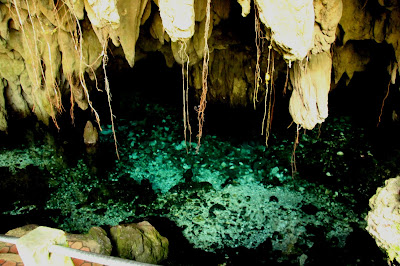
We rented a cab for the day so we could go into town and get our cellphone SIM cards setup (for the sole purpose of being able to publish this blog). While on the way we took a local teacher with us, Kenny, to show us around the island. We stopped at the local Huan sacred caves, filled with clear water that has percolated down through the limestone. The islands ancestors stop by the caves and reconnect with those who are still among the living.


 We stopped by the seaweed farm processing center. They seed areas offshore and go out in small boats and harvest the seaweed.
After harvest it is laid in the sun and dried before being shipped out for further processing and export.
This is what is called a Dutch 'table cannon' here. It is left over from the Dutch colonial times. This one is planted in some concrete to mark an offering plate at the Huan park. The interesting thing about these cannons is that when a man wants to take a bride on the island, it is traditional for him to give the bride's family a table canon as a sort of dowry. These are not replicas, but actual Dutch bronze cannons or guns from the good ole days, say the 1600's. Besides being colonized by the Dutch, these islands were also occupied by the Japanese during World War II from where they conducted air raids on Australia.

 Some of the colorful buildings in the main city area of Tual and Langur.

And the traffic jam we created when the taxi driver asked if we wanted to take a picture from the bridge that connects Tual and Langur. He just stopped in the traffic lane (no shoulder) and we got out to click while all these cars and motorcycles had to sneak into the incoming lane to get by. As friendly and helpful as everyone we've met so far has been, I'm still thinking there were more than a few Damn tourist uttered by these drivers.


After getting SIM cards, a stop at the ATM and a great lunch, we headed to the market to get some fresh vegies. Always a colorful event.


Kenny, our guide for the day really wanted to show our boat to some of his family, so we setup for them to come out the next day. Our boat and ourselves are now in a lot of local pictures.

Tomorrow we head of for a small island about 15 miles west of here to try and get in some snorkeling in what is said to be the clearest water around here with good corals. Then in a few days we will do an overnight sail to the Banda islands, the heart of the historic East Indies spice trade and key to many historic world events of the 1600-1800's.

Paul


Thursday, July 25, 2019

Enroute Indonesia

We arrived at Debut around 13:00 local time. We had heard from friends that all the officials for clearing in were there, so we decided to head to this town instead of the main one, Tual. We have our yellow Q-flag up requesting clearance. Hopefully it will happen in the morning.

Paul

--short

----------
Sent via SailMail, http://www.sailmail.com

Wednesday, July 24, 2019

Enroute Indonesia

The winds picked and we made good progress overnight. This afternoon the winds got very light. Either way this should be our last night out, with an arrival in Tual late tomorrow afternoon (Thursday our time).

The first class cabins were offered a hot shower today, which was a big hit.

Paul

--short

----------
Sent via SailMail, http://www.sailmail.com

Tuesday, July 23, 2019

Enroute Indonesia

When we left Tasmania earlier this year in he Austral summer, we were passing through the Tasman Sea. Then going up the Queensland coast it was the Coral Sea. From Thursday Island to the Kai Islands in Indonesia it is the Arafurta Sea. Not sure how many of these are part of the proverbial Seven Seas.
The winds picked up a little overnight making our noon-to-noon run 156nm.
In the first class cabins complimentary, chilled grapefruit was served today.
--short


----------
Sent via SailMail, http://www.sailmail.com

Monday, July 22, 2019

Enroute Indonesia

The first two days out have been fairly mild. We are taking the long route to the Kai Islands by crossing the Gulf of Carpintaria (the big bite on the north coast, east side of Australia) directly west, then turning north once we get near the Wessel Islands. The reason for this longer route is to minimize exposure to the fishing boats and the 3 to 4 mile long free floating nets on the direct route. The Sail2Indonesia Rally boats left ahead of us and many that took a more direct route had difficulties. One boat was hung up in a net at night for 4 1/2 hours. Another counted over 40 fishing boats in what looked like an offshore village. The boats that took the westerly route encountered a few fishing boats and nets, but it seemed much less than the direct route.
First day noon to noon we did 156 miles. Second day 125 miles in light winds. We just have the main up as we are pointing close to DDW (Dead Down Wind). Looks like this longer route will add a full day to passage.

Paul

--short


----------
Sent via SailMail, http://www.sailmail.com

Friday, July 19, 2019

High Risk Shelling


We anchored about 200 yards off of Horn Island, the anchorage of choice near Thursday Island. This croc, or in Aussie terms, Saltie, was laying on the bank. For us whimps, even this Florida boy, it's a little daunting. Definitely no shell hunting on this beach. While the croc teeth look pretty intimidating, apparently they open their mouths to cool off -- at least that's what the Aussies tell tourists. Definitely good dentition.


Here's a gruesome old picture of a local opening the stomach of a 26 foot saltie and laying human body parts next to it. Apparently it still happens.


If the crocs weren't bad enough, this large shark is cruising the murky waters next to the dinghy dock.


 Next stop was the Australian Border Force to clear out. We took the short ferry from Horn to Thursday Island and went to visit Her Majesty's Customs House. A classic building from the colonial period. It took about 40 minutes to clear out, but we are now free to go tomorrow.

____________________________________________


Horne Island was a major airbase in the Second World War and the most northern one for the Royal Australian Air Force. It was also used by the US Air Force extensively. Northern Australia was attacked by the Japanese-- Horn was the second most bombed part of Australia in the war (behind Darwin). We took a great tour of the WWII sites on the island with Vanessa as our guide. Highly recommended. She and her husband, with the assist of the military and volunteers, are slowly pushing back the overgrowth and preserving the sites around the island's airfield. This gun was part of the a circle of three that protected the area.


It took a large team to rapidly fire these guns at the Japanese Zeros coming in overhead.


There are many plane wrecks around the close by islands. This is the remains of a rotary engine at the crash site of a US B-17 Fortress bomber.

A termite hill, taller than Chris, in a land full of termites. Just reminds us of how long the ABF Quarantine officer inspected Georgia on entry to Australia looking for... termites.
__________________________________________________

We are off on tomorrow, our Saturday, around noon. We should have about a 5 day passage to Tual, in the Kai Islands, our port of entry in Indonesia. I'll try and post a note to the blog while we are enroute.

Paul


Getting to Thursday island


It's a long, empty haul from Lizard island to the top of Australia. There's pretty much no towns along this stretch of water and Telstra, the cell company, doesn't waste any money on installing any cell towers. So we've been out of touch. From where we started south of Brisbane, Gold Coast, to where we've ended, here in Thursday Island, it is about 1,200 nm.  This area is heavily guarded by the Australian Border Force. Aussies seem to have a morbid fear of immigrants arriving by boat. We were buzzed at strafing altitude by this ABF plan. He then had us get on the VHF radio to give him details. The radio operator said to me "I see you are registered in Seattle from your stern". I said back to him, "Looks like you have a rally good lenses on that thing". His response was "Yes, I see it was a quarter past three on your wristwatch". Nothing a like humor from the military.


The stops along the way were relatively uninspiring (Flinders Island, Morris Island, Margaret Bay, Escape River and Mount Aldolphus Island). Above is Restitution Island, near Cape Grenville. It was named by Capt Bligh of the Bounty mutiny fame. This guy was an absolutely amazing navigator and if you read other sides of the mutiny story, a good and fair captain. Navigating a boat through these reefs systems while making charts all along the way was definitely a feat of a true iron man.  Bligh named Restitution Island for the rest he finally gave his men when they arrived in the open boat they had been set adrift in from Tonga. Bligh thought it would be a good spot to get some oysters, stock up on some water and hopefully not get attacked by the Aboriginals. 
This is Sunday Island in the early morning as we leave Margaret Bay on a Sunday. (That's an 800 foot tanker on the horizon-- travelling inside the Great Barrier Reef). Bligh stopped here on Sunday. This was a good sign as we were heading for Thursday Island.

The route inside the Great Barrier Ref is a major shipping lane. The depths in the winding shipping lanes are adequate for large cargo ships. Navigation lights allow the ships to weave among the reefs. To maintain the lights in this remote region each major light has an attached helicopter platform.


The weather on the northern end of the rip was rambunctious, with the entry and exit from the Escape River anchorage a little trying. We exited the Escape River in the morning motoring into 30-35kts of wind and 4 foot seas as we pasted the bar. Once outside into deep water Chris said she was going down below to tremble for awhile. The 56ft German boat above, Frenweh 3, followed us out over the bar.

Next stop, anchoring at Horn Island just across the cut from Thursday Island. TI is the administrative center of  the Torres Strait Islands and where we will clear out of Australia.

Paul


Sunday, July 14, 2019

Heading to Lizard Island


After a good week of civilization in the Cairns marina we headed north with a full load of fuel and groceries. Fueling was a little trying as we had to deal with a very grumpy fuel dock attendant. He was fine with us, but just livid about the rudeness of the cruising boat that fueled before us. They were 20 minutes late for their 30 minute  fueling appointment and according to the attendant they were the rudest customers he ever had. He wanted us to tell him how he could complain to the Sail2Indonesia Rally about this boat. After having to re-tie up at our dock to wait for the other boat to complete fueling, all went well and we got a hearty “Good sailing, mate”  from the attendant. Not all cruisers leave a clean wake.

Our first stop out of Cairns was a bit of a bouncy night on a public mooring at the Low Islets. Above is the Low Islets lighthouse established in 1878 and not automated till 1990.


The sailing in this portion of the Great Barrier Reef is really good. The winds are consistent from the S to SE and with the reefs closer into the mainland the seas are much smaller. Next stop was the Hope Islands. This is East Hope Island where we picked up another public park mooring. Its pretty tricky getting through the reefs to the anchorage. You definitely want to have some sun at your back to see the partially submerged reefs. We got there at low tide and had a long shell hunting session on the dried reef and island beach. I’d show you the haul, but Chris is still cleaning them up.


On our way sailing north we passed close by the Pickersgill and Endeavour Reefs (the two green spots on the center right above). Captain Cook (who at the time was a lieutenant, but Master of the ship Endeavour) came past this way in 1770. He was sailing inshore and saw the Hope Islands ahead late in the day. To avoid them he started out to sea as night fell. His men were continually taking soundings. They would throw a weighted line overboard near the front of the ship and walk back with it as the shipped moved forward. The line was marked every fathom: 6 feet, about the length of a mans out stretched arms. The weight at the end of the line had a hollow in the bottom with tallow shoved in it. This allowed the type of bottom to be determined: coral, sand, mud, etc. When the bottom could not be detected by the depth line the ship was said to be off-soundings.
Some time after dark the shallows were briefly detected.  This was probably the NW corner of Pickersgill Reef, near where the yellow light symbol is on this chart. The waters got deeper and the crew relaxed a bit. They they ran square onto the reef now known as Endeavour Reef. After jettisoning much of their supplies, canons and ballast they were able to free Endeavour from the reef. Badly damaged they headed into the shore.


This is me re-enacting Cook’s voyage into the Endeavour River. He brought his damaged vessel into this shallow river that takes its name from the ship and the associated town is Cooktown. They stayed in the river repairing the Endeavour for 48 days, the longest any Englishmen had been on Australian land till then. They recorded the first English siting of kangaroos and made a reasonable peace with the local Aboriginals. 
We didn’t stay in Cooktown as the depths were just not conducive to us having a good sleep while on anchor. So we continued north and spent a decent night tucked behind Cape Bedford.


The next cape north is Cape Flattery. Here is yet another bulk carrier getting loaded with silica off the Cape. It is pretty amazing how much of Australia is being dug up and sent overseas. In return, lots of cash gets sent back to Australia and the standard of living is pretty high, with an especially strong middle-class. Cook named Cape Flattery because he felt when he initially saw it it would offer Endeavour’s way out of the reefs and back into the ocean. Unfortunately he was only being ‘flattered’.


This brought us to Lizard island. Can you guess why Cook decided to call this Lizard island? I think I’ve deduced it after hiking around. This little guy was close to 2 foot long. The island has a really nice anchorage along with high end private resort.  Cruisers are only allowed to visit the bar and that’s only on Monday, Wednesday and Friday evenings—otherwise known as pizza, hamburger and taco nights.

Cook hiked to the highest point on the island, conveniently called Cook’s Lookout. He was tying to spot his passage out of the reefs. You can see a large reef off the island near the horizon in this picture.


We also hiked the trail up the mountain. It’s a pretty tough hike definitely requiring real shoes. The hike not only offers some great views of the surrounding reefs, it also gets you high enough to pick up a Telstra cellphone connection after about an hour of hiking.


Critters on the trail

Critters on the trail


The island’s ‘Blue Lagoon’


 Georgia at anchor


The reef next to the anchorage offed some surprisingly good snorkeling. These are some of the largest giant clams we have ever seen. You wouldn’t want to have a foot inside one of these when they closed up.

The area supports a pretty healthy turtle population.


Along with some creatively colored crabs.


 Long beaches

Now you might know these sheds as Outhouses or Johnny-on-the-spot, or even the Shit House.  As usually, in ‘straya they have their own creative terminology. You are looking at the Long-drops.

Tomorrow we leave Lizard island for about another week of travel to get to the top of Oz, at Thursday Island.

Paul


Tuesday, July 2, 2019

Magnetic Island


Looking back at Double Cone Island

On our way out of the Whitsundays we did a brief stop at Double Cone Island. The anchorage was rolly and windy, but not enough to stop dedicated shell hunters. The island is supposed to have a lot of cone shells on the beach. Unfortunately, the shell collecting was a bust, with the beach walk still nice. Lately we've taken to blaming our friend Judy on Fair Winds whenever a beach has no shells, as she is the consummate shell hunter and is travelling ahead of us on this passage.


On the way north we sailed past Abbott Point. This pier sticks out from the land 1.3 miles. It is the major coal loading point for Queensland. There were a dozen large bulk carrier ships at anchor offshore, just waiting their turn to head to the pier, turn on the conveyor belt and load up with beautiful, clean Australian coal, headed to India.


We cut into the shallow entrance to the canal that separates Hinchinbrook Island from the mainland. It was dead calm inside and a nice motor up the well marked channel. We are well into croc country now, but didn't see any in the surrounding mangroves. We expected to see more birds, as it looks like a perfect environment for them, but there weren't many -- a rarity for Australia that seems to have an unlimited number of cool birds.


We spent four days in Magnetic Island, anchored in Horseshoe Bay (above). Really nice place. The island was named by Captain Cook. He thought his compass was messed up in the area and attributed it to some disturbance caused by ores on the island, hence Magnetic Island.  Turns out he was wrong about the island's effect on compasses, but it does have a magnetic draw for tourists and retirees. 


It's easy to get around Magnetic Island - lots of walking trails and a public bus that runs often. We took the bus to the start of the Fort Trail. This trails heads up the mountain to the World War II gun embankments.  Looking at the rusty stuff was good, but had to take a serious backseat to the free-range koalas along the trail. 
Of course I also had to deal with the continuous signs warning about the common death adders on the trail. I think there is a symbiotic relationship between the koalas and the death adders. You walk along the trail continually looking down to avoid any sneaky snakes. But then your eye catches a cute, big eyed, cuddly koala in a tree. You stare at it and start taking pictures -- this is just when the death adders strike. At least in my mind. 
This jar containing a Common Death Adder was sitting on the counter of the convenience store at Horseshoe Bay, just where you pay. 


 After we left Magnetic we headed north toward Cairns, stopping at the cyclone damaged Dunk Island. On the way the HMAS Canberra and Adelaide were anchored offshore, carefully guarding our passage north. HMAS: Her Majesty's Australian Ship. They just can't let go of the royals thing here.


The large, public, open-air pool along the strand in Cairns.
We're now in the marina in Cairns - pronounced Cans for some unknown reason. Great place to stock up, catch a movie and generally enjoy land life. Next up: the 495 nautical miles passage to Thursday Island in the Torres Strait at the very top of Australia.

Paul