Showing posts with label Vanuatu. Show all posts

Sunday, October 8, 2017

A Little Bislama

EfateIMG_7939
After Erromongo we sailed up to Efate island and into the capital of Vanuatu, Port Vila. It’s an easy town to get around and reprovision. I’ve spoke a couple of times in the blog about the Bislama language spoken in Vanuatu. It is a fairly sophisticated pidgin English. You can often understand what is written and sometimes understand a small amount when you hear it spoken.
One of the most endearing expressions is tenk yu tumas. Thank you very much. If you look at these papayas in the market, you’ll notice that the sign says  No Prestem Po Po. Don’t squeeze paw paws!
ErromongoIMG_7901
Emergency instructions for Etkwek (earthquake) and Tsunami posted in the village.
ErromongoIMG_7862
Here’s a more complicated message letting every parent know about the fees that are due for school.
EfateIMG_7955
The National Museum of Vanuatu – pretty easy to translate.
EfateIMG_7954
The museum has a good collection of artifacts from early Vanuatu populations and some good discussions on the culture. Vanuatu is known for the tradition of sand painting. The sand is smoothed out and then a picture is drawn with one finger without lifting it while a story, related to the picture, is told. These stylized pictures represent events from Vanuatu’s history, ancient and more modern. This one was done by a young lady during a demonstration in the museum. It tells the sotry of one village’s experience with the Blackbirding ships that came to the islands and essentially press-ganged local men to go work in the Australian cane fields. An estimated 40,000 ni-Vanuatu were ‘recruited’ between 1863 and 1904. Some islands, like Erromongo, were hit very hard and the population is still recovering.
EfateIMG_7962
We sailed around to the NW corner of Efate to the area called Havannah Harbour. It was the location of the original colonial settlements. They were moved to Port Vila after a drought (the west sides of the islands are typically dryer due to the prevailing SE Tradewinds). During World War II this was an American naval and air base in support of the attack on Guadalcanal.
Going up the bay we saw this two masted boat on the reef. From a distance it looks like a normal sized cruising ketch. But up close it is really a mega-yacht. The catamaran that is in the picture above to the right of the ketch is 45 feet long. The yacht is named Blue Gold and it went on the reef during Cyclone Pam in 2015. The owner was arrested in Switzerland and charged in the Netherlands over various financial issues apparently not related to the yacht.
EfatePA050087
Blue Gold is being watched by one of the islanders living close by and has not been stripped. Up close the steel hull looks in good shape and ready for salvage. The water off its stern is deep, so salvage should be fairly straight forward. Just when the salvage will occur is an open question.
EfateIMG_7960
This is the bay that Blue Gold was in when it broke free during the cyclone. We anchored just off to the left. If you look closely there are a couple of yellow mooring balls in the picture. When we anchored there were four large yellow moorings arraigned in a square. These were installed, after Pam, as cyclone moorings for larger ships. When we woke in the morning, one of the yellow moorings had drifted off to another location?????????
EfatePA050097
Not ones to miss out on a world class museum, we took the dinghy for a long ride in to find the WW II Museum. It took asking three different people to actually locate it, but of course it was well worth it. With a motto like Rust In Peace how could you not like it?
EfatePA050091
Once inside you find out that the focus of the museum seems to be old bottles, with Coca Cola bottles leading the way. Here Chris is looking at some of the latest Coke finds. The guy in the red shirt is the grandson of the museum founder and the current operator. If you are old enough you probably remember that Coke bottles had the bottling company city and state embossed in the glass on the bottom of each bottle. I remember working in a welding shop as a kid. At break time we would through in a few quarters to a pot and who ever got the break-time Coke bottle from the furthest away bottling plant was the winner. Since all the bottles had a nickel deposit and were re-used in those days, bottles ended up getting distributed all over the country and world. Chris is looking at a bottle marked from Albuquerque NM, her old home town.
EfatePA050094
The museum also has some serious art work and some unexploded ordinance as well.
EfateIMG_7940
Flowers for sale in the market.
We cleared out of Vanuatu today in Port Vila. A quick trip to Immigration and then Customs stopped by our boat. We will hang out for a few days until we see a good weather window, then we are off to Noumea, New Caledonia. The passage should take 2 to 3 days.
Gut naet (good night)
Paul

Saturday, October 7, 2017

William’s Bay (aka Dillon’s Bay)Erromongo, Vanuatu

TannaIMG_7827
We got up early in Port Resolution Bay and picked up our stern anchor that we had set out previously, to keep the bow pointing into the small swell and not rocking the boat, then grabbed the bow anchor and headed north for Erromongo. Mount Yasur was still smoking as we passed offshore in the early morning.
ErromongoIMG_7833
When we got to the north end of Tanna we were briefly visited by some large dolphins. They seemed to not be all that interested in playing with our bow wake like the dolphins we’ve encountered in other places… just coming by to say hello.
ErromongoIMG_7835
We arrived at William’s Bay late in the afternoon. There were two cruising boats in the anchorage, both boats we had met in Port Resolution. Chief Jacob quickly paddled up in his outrigger and introduced himself. We invited him onboard for a late coffee and some cookies. A very interesting and friendly man. He told us a lot about the village and island.
He is a great football fan (soccer for you Yanks), so we gave him one of our soccer balls. These are really high quality balls that we got from brother-in-law Juli Vee and the chief was suitably impressed. He invited us to come in tomorrow to see his houses and garden.
ErromongoIMG_7848
This is Chief Jacob’s wife and children. Notice that the little girl is playing with a large, sharp knife. This is not unusual here and you never see the parents hovering over the kid saying Be careful. I’m assuming there is some genetic transfer of knowledge that keeps them safe from slicing off body parts.
ErromongoIMG_7845
The bay we are anchored in is named Dillon’s Bay on most charts. Peter Dillon came to Erromongo from Australia in the early 1800’s to harvest sandalwood trees. The locals pretty much sent him trucking on his way without a load of sandalwood. Latter King Kamehaeha of Hawaii sent two ships full of Polynesian Hawaiians to take over the island to gather sandalwood. This also didn’t go over well with the locals and only 20 of the 479 Hawaiians made it back to Hawaii.
With this general distrust, or perhaps disgust, of foreigners did not bode well for the early missionaries. John Williams of the London Missionary Society showed up in 1839 and was promptly killed and eaten by the Erromangans. About 170 years after his death his descendants arrived on the island for a reconciliation ceremony. The islanders are now very religious and have multiple churches in the small village. The bay was renamed William’s Bay in honor of the eaten missionary.
The plants you see in the center of the picture above are part of a sandalwood nursery. Many of the locals plant them on their land and are able to harvest them in 15 to 17 years. A decent sized tree will pay for a year or more of schooling.
ErromongoIMG_7851
The walls of the homes are typically woven of bamboo and the roofs are palm fronds. This is Jacobs’s house here, recently rebuilt after being flattened by Cyclone Pam. The family stayed in a large cave on their property during the storm.
ErromongoIMG_7892 It turns out that we are not the only country to have bewildering politics. William’s Bay has two chiefs. This picture is Chief Jason. He appears to us to be the administrative chief of the main village. Chief Jacob owns a large portion of land right on the bay and up the hillside (this is land that he has recently gotten title to by applying to the Vanuatu Supreme Court) and Chief Jason owns land on either side of this. After we met Chief Jason we asked him if we could get permission to visit the Caves. He told us to come back at 2pm and he would guide us. At two we all jumped in the dingy and headed to a beach about a mile north of the village.
Jacob walked us on a short trail to this cave entrance while telling us about the island and its people. At the cave entrance he stopped and asked ceremoniously to the cave inhabitants if we could have permission to visit.
ErromongoIMG_7889
Chief Jason and Chris inside the cave. You can tell that it was really interesting because Chris has not yet melted down from her claustrophobia.
ErromongoIMG_7887
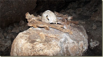
Buried in the cave are Jason’s ancestors. The island has been inhabited for two or three thousand years. These remains looked a lot more recent.
ErromongoIMG_7896
ErromongoIMG_7891
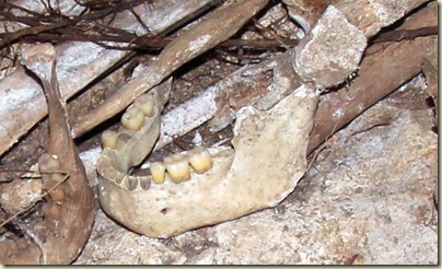
Those are pretty healthy looking teeth.
ErromongoIMG_7895
There is an old belt buckle lying next to these bones.
ErromongoIMG_7898
When we left the cave Chief Jason solemnly thanked the inhabitants for allowing our visit and then put on a nice smile for the photo. Chris is just smiling because she is no longer in a cave.
ErromongoIMG_7914
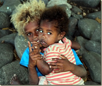
The kids in the village were all interested in us and friendly, except for this girl in the red stripes. She seemed scared to be around us. The school teaches in both French and English. The village speaks its own Erromangan language as well as the national language, Bislama. The Erromangan language is related to the languages in Papua New Guinea and the Solomon Islands.
ErromongoIMG_7922
We were invited to stop by for a snack that turned out to be lunch at Donald and Lotties house. She is putting together a private kindergarten for the local kids. Chris brought some school supplies plus our last small child’s soccer ball.
ErromongoIMG_7924 Donald and Lottie in front of the kindergarten building they built on their property.
ErromongoIMG_7933
While we were there an Australian aid group brought in a new tractor and some supplies to aid in local farming. The whole village came out to hellp with loading and unloading.
ErromongoIMG_7909
Just prior to the ship arriving some of the locals went off to harvest some rose wood. These planks will be sent up to Port Vila on the cargo ship to be sold. The proceeds are to pay for school for the tree’s owner’s kids.
ErromongoIMG_7904
We saw this collection of stones on the beach and had to ask what they were all about. They are also going to Port Vila, to be used in making the national dish “laplap” which looks a bit like Mexican tamales.
ErrormongoIMG_7868
The village is located beside a clear river that flows through an idyllic looking valley.
ErromongoIMG_7875
The size of the tropical trees here never ceases to amaze me. That’s Chris with the red shirt walking up toward the trunk of this medium sized banyan tree, mid-left of the picture.
ErromongoIMG_7921
William’s Bay was a really interesting stop. We wish we had a little more time to explore Vanuatu.
Paul

Friday, September 29, 2017

Maw of the Beast

YasurIMG_7817
Now I’m not one for keeping any sort of Bucket List, but if I did I would have had near the top of the list going to the edge of an active volcano and peeing in. So, in that vein we headed to the tour up Mount Yasur here on Tanna Island, Vanuatu.
YasurIMG_7647
At the base of the low mountain they do an introduction to the volcano trip and have the local village group do a ‘kastom’ dance asking permission from the local gods for a safe voyage to the volcano. Kastom means customary or tradional culture in the Bislama langauge. The scene is a little contrived with each tourist group holding a sign indicating what country they are from, but the dance is real.
YasurP9240002
The 30 or so of us jumped on the trucks at the base camp and had a fast ride up the mountain in the late afternoon. Then a brief hike to the rim for a safety briefing from our guide which consisted of the advice if there is a big bang and a lot of lava bombs coming your way, do not run. You can see the smoke and steam rising here in the back ground as our guide gives us the low-down.
YasurIMG_7661
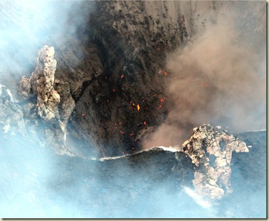
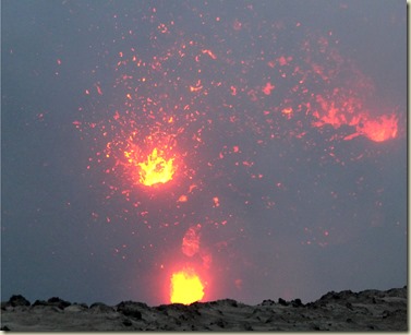
As you walk up to the edge of the crater rim in the day light you start to see the red glow from below. There is a muffled roar coming out of the crater that sounds like continuous surf breaking. The sulfuric smoke comes and goes as the wind changes. There are occasional loud explosions.
YasurIMG_7670
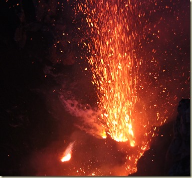
The explosions shoot lava bombs hundreds of feet into the air.
YasurIMG_7705
As the afternoon gets darker the crater turns into a glowing fiery pit
YasurIMG_7735
Sometimes you feel just way too close to this energy. A quick look at the two guides we had was somewhat reassuring as they didn’t seem to blink, even when the bombs were landing high up the crater edge. They did mention something in the briefing about safety being the most important thing.
YasurIMG_7749
As we watched new vents would start up and blow hot holes into the crater base. We could see the molten lava churning inside them.
YasurIMG_7790
Think of Roman candle fireworks the size of a a very large warehouse building (just oneof the vents) early on a 4th July evening.
YasurP9240023
When we were on this edge of the crater the wind was probably gusting to 30kts. The fine lava sand was brutal on the eyes, hence the safety goggles. It was cold on the edge, even though you had a direct connection to the heat of the central earth.

The Yasur volcano is a ‘stratovolcano’, one built up from many layers of hardened lava. When we dinghy around the anchorage at Port Resolution you can clearly see the stratification along the north bay edge which is the volcano side.
YasurIMG_7755
This is the birthplace of all the Pacific islands, along the edge of the Ring of Fire. The Hawaiians say the angry goddess, Pele, inhabits these volcanoes. Thanks to our friend Mike up in the San Juans for letting me borrow his phrase, we were truly gazing into the ‘maw of the beast’.
Paul

Sunday, September 24, 2017

Port Resolution, Vanuatu

TannaIMG_7541
This pic was taken as we arrived in the early morning hours to Port Resolution on Tanna Island. The cloud you see drifting toward the north is volcano dust and steam being ejected by Mt. Yasur. I suspect it looked similar to this when Capt. Cook arrived in 1774 and named the bay after his ship, HMS Resolution. With a name like Port Resolution you’d figure it was a port town. Nope. Over the years the bay has gotten shallower. It is has a few very small subsistence villages around it, no stores or docks or really anything.

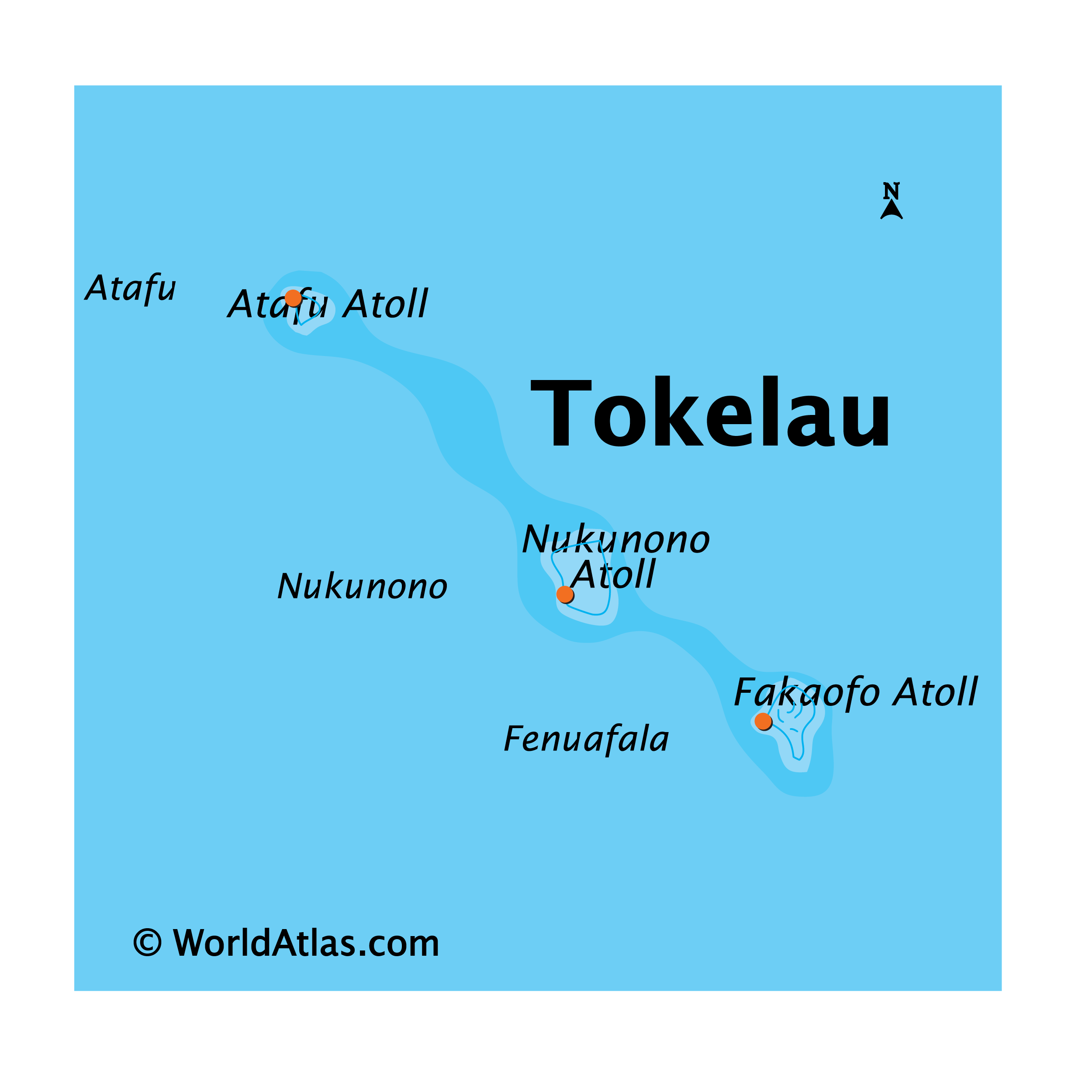
Now you don’t have to feel uneducated or non-worldly just because you have less than a vague clue as to where Vanuatu might be. Prior to getting to the South Pacific I wasn’t sure if it was a country in the SP or an imaginary location from a Michener story. (You can click on the maps to biggerate). Vanuatu was previously known in its colonial days as the New Hebrides islands. The French and English took joint control of the islands from the local Melanesian population and ran it as a Condominium form of gov’t. Not sure what a government Condo really is but they setup duplicate ministries and officers for all government posts and jointly governed in that remarkably inefficient way that only Colonial gentlemen can govern. They made some historic decisions while presiding over the islands, such as what side of the road to drive on. The Brits were driving on the left and the French on the right. Even with almost no traffic in the early 1900’s this situation couldn’t last long. They met and discussed. And met again and discussed again, resolving the issue in a Solomonesque bureaucratic way. The next vehicle to be imported into the country would decide which side of the road all would drive on. A new carriage came in on a ship from French controlled New Caledonia and the country drives on the right side of the road ever since.
TannaIMG_7546 The closest village to the bay has a Yacht Club, an open air structure on the cliff overlooking the bay. They offer this as a service to cruisers – who then use the villagers to get rides into town, setup tours, etc.  The village is very possessive of the ‘rights’ to do business with the cruisers and don’t like it when cruisers deal with the other smaller village at the head of the bay. Customs and Immigration came over from Lenakel, the main town and official port of entry, to clear us in. Lenakel is on the east side of the island and has what I would describe as an anchor eating, rolly, barely protected anchorage. Much better to come into Port Resolution than to try and anchor on the Lenakel side. Clearing in costs about $120(US) including a $50 fee for a biosecurity check. No actual Bio-security agent or on-board inspection. It also included the checking in fuel charge for C&I to drive across the island, shared among cruisers.
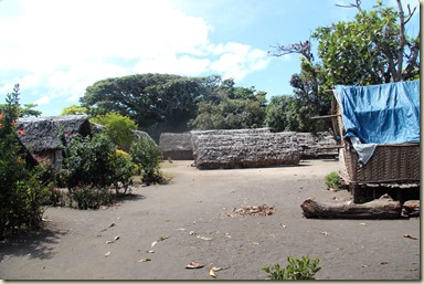
TannaIMG_7552 The village houses are pretty basic and you can see how the cyclones can wipe them out pretty easily. The good news is that they rebuild quickly.
TannaIMG_7557
The kids seem happy and healthy, love the beach and are always playing with each other somewhere.
TannaIMG_7618
We joined a group of cruisers (all Ozzies) who needed to go into Lenakel to exchange money, get a SIM cards for their phones and checkout the market. The road trip across the island takes about two hours- one way. The first half or 2/3 is rough dirt road. The next third is graded dirt road with about 0.1% concrete or asphalt. We picked up locals on the way. If you were one of the unlucky cruisers who got space in the back of truck it was one dusty ride. Being old and whiny about my sore back I got to sit in the cab.
TannaIMG_7573
On the way we stopped at the side of the road to pickup some fresh bread at the Bread and Benzine stop. Benzine being what they call gasoline or petrol. (Masui is diesel in the local language). The Ozzie, Mike, in the blue shirt facing Chris in this pic, promptly pulled out his little plastic bag with butter and, of course, Vegemite to put on his fresh rolls!
TannaIMG_7599
After exchanging cash at the bank, where there are no ATMs that accept international cards, we headed off to the nicely stocked vegetable market. The couple of general grocery stores around the market had very little unless you needed packaged Asian noodles (think Top Ramen) or breakfast sweet biscuits (think saltines with more body, much less salt and a dash of sugar).
TannaIMG_7605
While the store doesn’t have a lot inside it it did have this remnant huge Giant Clam shell outside, unfortunaely it had been painted.
TannaP9220168
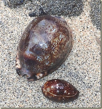
Speaking of shells, it was overcast the other day and we did a short shell hunting adventure. Pretty good haul, including these pristine cowrie shells.
TannaIMG_7607
There are giant banyan trees all over Tanna. Apparently they use the roots of female banyan trees for construction. The male trees are reserved for sitting around and drinking kava. This tree is in town and the spot to stop when you need to get some kava to take home on a Friday night. Our taxi driver pulled over here so some of the excess passengers could get their liter water bottles filled with the mud-colored liquid kava. By the time we got back to the village the taxi, a Toyota 4-door cab pickup Hylux, had 14 people in it (or on it). I, fortunately, was sitting in the front seat and had the single seat belt.
TannaIMG_7613
The scale doesn’t show too well in this picture. This is the backside of the Mt. Yasur volcano showing its acres of volcanic dust that we drove across.
TannaIMG_7627
We went to the village in Sulphur Bay on Friday night to see the Jon Frum Friday night ritual. The Jon Frum culture was a response to repressive European missionary practices (msome of those guys were eaten). It is part of the Cargo Cult religion that believes all needs will be provided to them as cargo showing up on their shores. The name Jon Frum derives from the phrase “John, from America”, as in, “Hi, I’m…”. During WWII the US brought previously unknown and almost unlimited material stuff to these shores, along with black American soldiers. Priests, known as messengers, now prophesize the return of ships laden with cargo to Tanna escorted by Jon Frum, the reincarnation of an ancient deity. The movement declares money must be thrown away, pigs killed and gardens left uncared for as all material wealth will be provided in the end by Jon Frum. Hmmm…
Tanna is the main island for Jon Frum practices. In WW II about 1,000 men from Tanna went to the island of Efate (where the capital of Vanuatu Port Vila is located) and worked on US military bases. The village that we went to see the celebration raises an American flag each day on a flagpole.
TannaIMG_7630The evening is oriented around ‘bands’ of maybe 8-15 people who belt out spiritual songs that came to the band leader while dreaming.
TannaIMG_7632
The men sing and play guitars and makeshift percussion instruments with the women singing backup. This little guy could be heard above the others as he enthusiastically and at high volume sang on. When his little brother got tired of strumming his small guitar and eventually fell asleep in Mom’s arms, he got to take over the guitar to add to his singing duties. Chief Isaac explained that the singing and dancing goes on from about 7-8pm to sunrise each Friday and that they sleep a lot on Saturdays. As typical for cruisers, we didn’t make it anywhere near the close of ceremonies.
TannaIMG_7572
Housing with a covered porch.
TannaIMG_7623
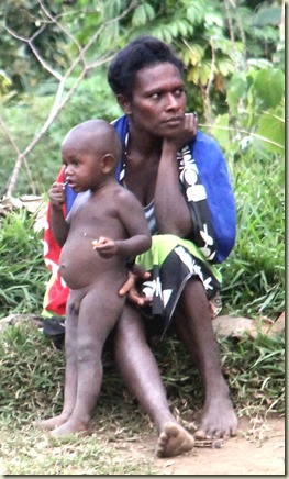
A little boy and Mom on the side of the road.
TannaP9220155
The side of the volcano works its way down to the waters edge of the bay we are anchored in. Just to remind us how close the volcano is, this is a steam vent at the edge of the bay, just next to our boat.
TannaIMG_7561
The Ni-Vanuatua grow up comfortable in the sea. A young man harpoon gig fishing
Paul